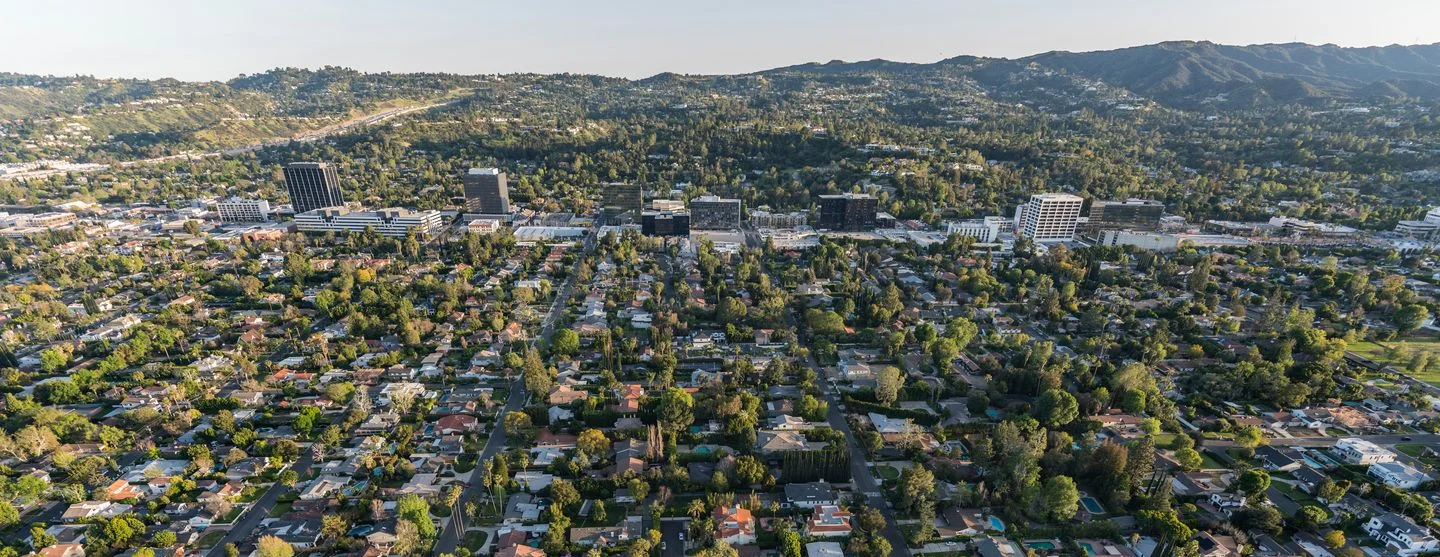
Sherman Oaks, CA

About Sherman Oaks

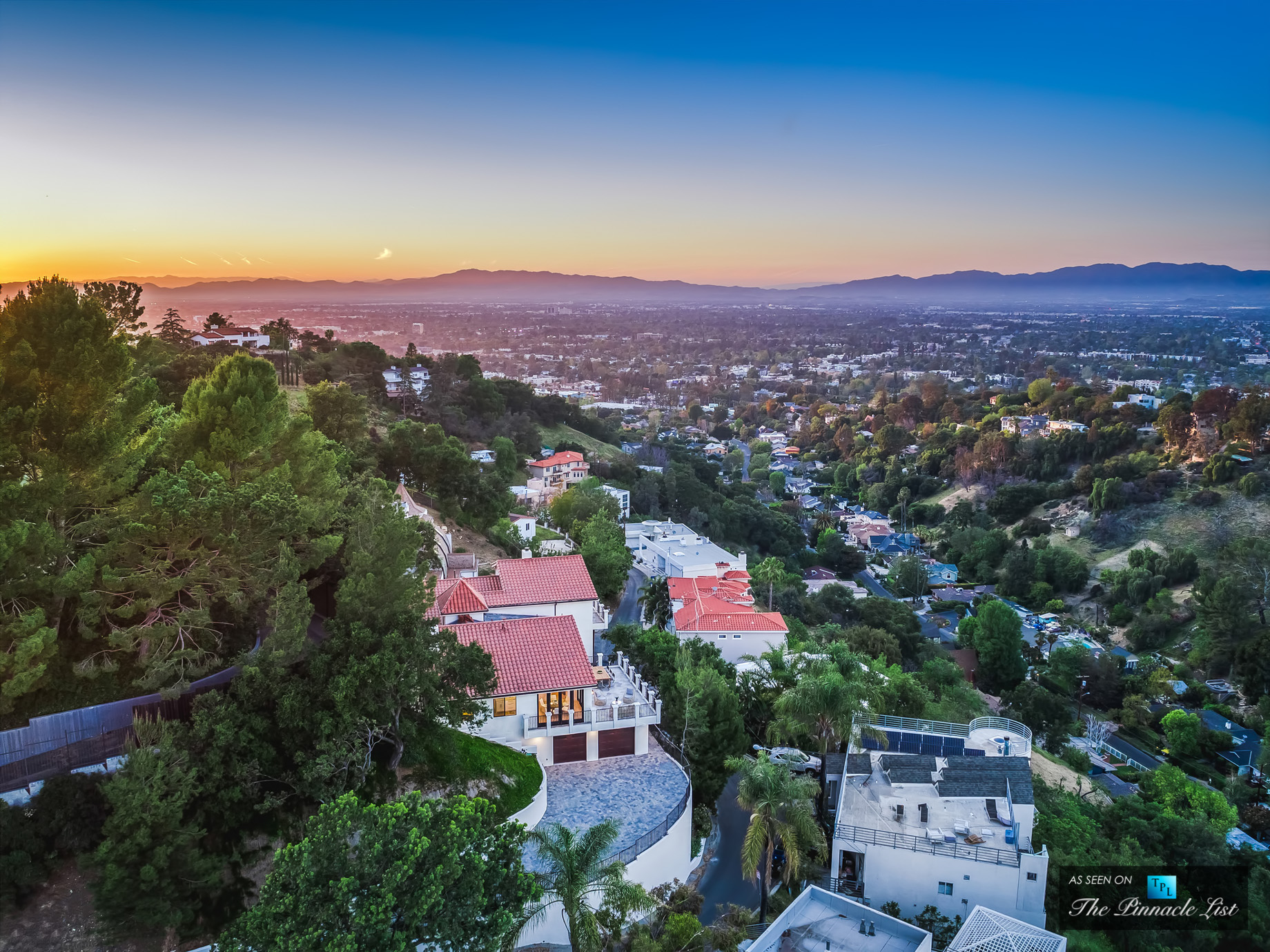
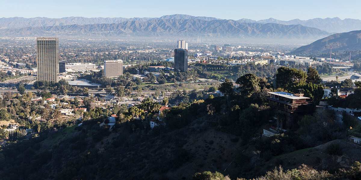
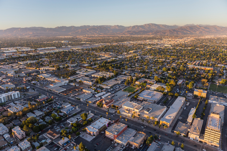
Sherman Oaks is a neighborhood in the San Fernando Valley region of Los Angeles, California, founded in 1927 with boundary changes afterward. The neighborhood includes a portion of the Santa Monica Mountains, which gives Sherman Oaks a lower population density than some other areas in Los Angeles.

A partner of the Los Angeles Suburban Homes Company, Gen. Moses Hazeltine Sherman, developed Sherman Oaks. The company had subdivided 1,000 acres (400 ha) of land that would become Sherman Oaks. In 1927 each acre was sold for $780. Sherman's other major venture was the Los Angeles Pacific Railroad.

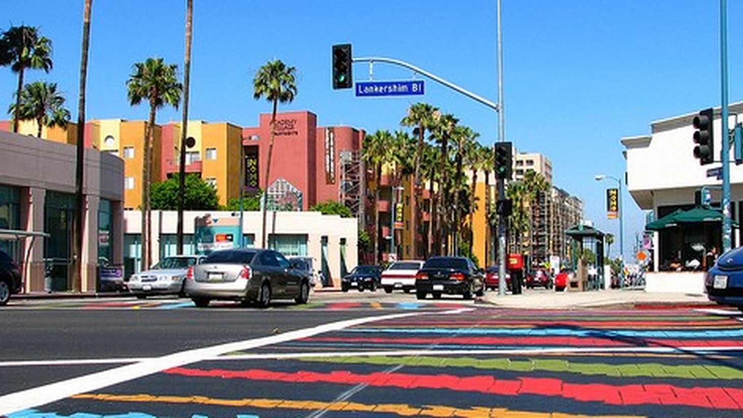
The neighborhood is roughly bounded by Studio City to the east, Van Nuys to the north, Encino to the west, Bel Air and Beverly Hills Post Office to the south.


Demographics


Total Population

Median Age

Median Household Income

Median Home Value

122,677

37.1

$72,072

$769,750


Studio City, CA

059-3619-Avenida-Del-Sol-Studio-City-CA-USA.jpg

About Studio City

Studio City is a neighborhood in the city of Los Angeles, California, in the southeast San Fernando Valley, just west of the Cahuenga Pass. It is named after the studio lot that was established in the area by film producer Mack Sennett in 1927, now known as CBS Studio Center

Originally known as Laurelwood, the area that Studio City occupies was formerly part of Rancho Ex-Mission San Fernando. This land changed hands several times during the late 19th Century and was eventually owned by James Boon Lankershim (1850–1931), and eight other developers who organized the Lankershim Ranch Land and Water Company. In 1927, Mack Sennett began building a new studio on 20 acres donated by the land developer. The area around the studio was named Studio City.

In 1955, Studio City's Station 78 became the first racially integrated station in the Los Angeles City Fire Department

Studio City is bordered on the north by Valley Village, on the east by Toluca Lake and Universal City, on the south by Hollywood Hills West, on the southwest by Beverly Crest and on the west by Sherman Oaks.

The Los Angeles River and Tujunga Wash flow through Studio City. The two concrete-lined channels merge just west of Colfax Avenue and north of Ventura Boulevard adjacent to CBS Studio Center.


Demographics


Total Population

Median Age

Median Household Income

Median Home Value

79,276

38.8

$82,509

$859,600


North Hollywood, CA

North_Hollywood_station_LA_Metro.0.0.jpg

About North Hollywood

North Hollywood is a neighborhood located in the east San Fernando Valley region of the city of Los Angeles. It is home to the NoHo Arts District and the Academy of Television Arts & Sciences, and it has seven public and eight private schools. There is a municipal park and a recreation center. The neighborhood is an important transportation center.

North Hollywood was established by the Lankershim Ranch Land and Water Company in 1887. It was first named Toluca before being renamed Lankershim in 1896 and finally North Hollywood in 1927. North Hollywood is home to the Academy of Television Arts & Sciences. Pierce Brothers Valhalla Memorial Park is located in the area, and includes the Portal of the Folded Wings Shrine to Aviation.

Universal Studios is also located on the border between Hollywood and North Hollywood, easily accessible through one of NoHo's main streets, Lankershim Blvd. Universal Studios has several attractions inside the actual park and in the non-paid CityWalk section. North Hollywood has several art houses, restaurants and theaters as well.


Demographics


Total Population

Median Age

Median Household Income

Median Home Value

227,355

35.9

$65,588

$696,183


Toluca Lake, CA

the_lake-1478643326-6316.jpg

About Toluca Lake

Toluca Lake is an affluent neighborhood in the city of Los Angeles located in the San Fernando Valley region of Los Angeles County, California, 12 miles (19 km) northwest of Downtown. The name is also given to a private natural lake fed by the Los Angeles River and maintained by neighboring property owners.

The history of Toluca Lake can be traced to the days of the Tongva Indians, followed by Spanish colonization and Mexican independence. Toluca Lake was part of the early rancho system. The original Toluca Lake was divided, with the neighborhood being known as Forman Toluca Ranch. In 1923, investors bought and developed the land as "Toluca Lake Park".

Like many City of Los Angeles neighborhoods, Toluca Lake has a central business district and mail can be addressed to either "Toluca Lake, CA 91602" or "Los Angeles, CA 91602."


Demographics


Total Population

Median Age

Median Household Income

Median Home Value

19,051

38.0

$81,917

$728,400


Burbank, CA

Burbank 1.jpg

About Burbank

Burbank is a city in Los Angeles County in the Los Angeles metropolitan area of Southern California, United States, 12 miles (19 km) northwest of downtown Los Angeles. The population at the 2010 census was 103,340.

Billed as the "Media Capital of the World" and only a few miles northeast of Hollywood, numerous media and entertainment companies are headquartered or have significant production facilities in Burbank, including Warner Bros. Entertainment, The Walt Disney Company, Nickelodeon Animation Studios, The Burbank Studios, Cartoon Network Studios with the West Coast branch of Cartoon Network, and Insomniac Games. The Hollywood Burbank Airport was the location of Lockheed's Skunk Works, which produced some of the most secret and technologically advanced airplanes, including the U-2 spy planes that uncovered the Soviet Union missile components in Cuba in October 1962.

Burbank consists of two distinct areas: a downtown/foothill section, in the foothills of the Verdugo Mountains, and the flatland section. The city was referred to as "Beautiful Downtown Burbank" on Rowan & Martin's Laugh-In and The Tonight Show Starring Johnny Carson. The city was named after David Burbank, a New Hampshire–born dentist and entrepreneur who established a sheep ranch there in 1867.


Demographics


Total Population

Median Age

Median Household Income

Median Home Value

102,511

38.6

$69,619

$654,900


Glendale, CA

Burbank 1.jpg

About Glendale

Glendale is a city in Los Angeles County, California, United States. Its estimated 2014 population was 200,167, making it the third largest city in Los Angeles County and the 23rd-largest city in California. It is located about 8 mi (13 km) north of downtown Los Angeles.

Glendale lies in the southeastern end of the San Fernando Valley, bisected by the Verdugo Mountains, and is a suburb in the Los Angeles metropolitan area. The city is bordered to the northwest by the Sun Valley and Tujunga neighborhoods of Los Angeles; to the northeast by La Cañada Flintridge and the unincorporated area of La Crescenta; to the west by Burbank and Griffith Park; to the east by Eagle Rock and Pasadena; to the south by the Atwater Village neighborhood of Los Angeles; and to the southeast by Glassell Park neighborhood of Los Angeles. The Golden State, Ventura, Glendale, and Foothill freeways run through the city.

Glendale has one of the largest communities of Armenian descent in the United States. In 2013, Glendale was named LA's Neighborhood of the Year by the readers and editors of Curbed.com.


Demographics


Total Population

Median Age

Median Household Income

Median Home Value

199,303

40.6

$78,800

$684,940


Pasadena, CA

colorado-street-bridge-6.jpg

About Pasadena

Pasadena is a city in Los Angeles County, California, United States, located 10 miles (16 kilometers) northeast of Downtown Los Angeles.

The estimated population of Pasadena was 141,029, in 2022. Pasadena is the ninth-largest city in Los Angeles County. Pasadena was incorporated on June 19, 1886, becoming one of the first cities to be incorporated in what is now Los Angeles County, following the city of Los Angeles (April 4, 1850). It is one of the primary cultural centers of the San Gabriel Valley.

The city is known for hosting the annual Rose Bowl football game and Tournament of Roses Parade. In addition, Pasadena is also home to many scientific and cultural institutions, including Caltech, Pasadena City College, Fuller Theological Seminary, ArtCenter College of Design, the Pasadena Playhouse, the Ambassador Auditorium, the Norton Simon Museum, and the USC Pacific Asia Museum.


Demographics


Total Population

Median Age

Median Household Income

Median Home Value

141,029

40.4

$103,479

$971,013


Reseda, CA

Reseda_-_Sherman_Way,_facing_East.JPG

About Reseda

Reseda is a neighborhood in the San Fernando Valley in Los Angeles, California. It was founded in 1912, and its central business district started in 1915. The neighborhood was devoted to agriculture for many years. Earthquakes struck the area in 1971 and 1994.

The neighborhood has fifteen public and five private schools. The community includes public parks, a senior center and a regional branch library. Parts of Reseda have been used in several motion picture and television productions.

The geographic name "Reseda" was first used for a siding on a branch of the Southern Pacific Railroad, which ran between the cities of Burbank and Chatsworth in the San Fernando Valley. In the 1920s, the name Reseda was transferred from the Southern Pacific Railroad to the Western Division of the Pacific Electric Railway "Red Cars Line", which had expedited development after the building of the Los Angeles Aqueduct. Later, it was used as the name of a stop on the Pacific Electric interurban railway running along Sherman Way.


Demographics


Total Population

Median Age

Median Household Income

Median Home Value

76,571

35.5

$60,413

$459,200


Van Nuys, CA

Sky LA Tower Sepulveda Building 2.jpg

About Van Nuys

Van Nuys is a neighborhood in the central San Fernando Valley region of Los Angeles, California. Home to Van Nuys Airport and the Valley Municipal Building, it is the only neighborhood in the San Fernando Valley with a population of more than 136,443.

Van Nuys became the Valley's satellite Los Angeles municipal civic center with the 1932 Art Deco Valley Municipal Building (Van Nuys City Hall), a visual landmark and Los Angeles Historic-Cultural Monument, starting the present-day Government Center complex of government services buildings.

Van Nuys is bordered on the north by North Hills, on the northeast by Panorama City, on the east by Valley Glen, on the south by Sherman Oaks, on the southwest by the Sepulveda Basin, on the west by Lake Balboa, and on the northwest by Northridge.[10] Its street and other boundaries are Roscoe Boulevard on the north, Sepulveda Boulevard, the Tujunga Wash, Woodman Avenue and Hazeltine Avenue on the east, Oxnard Street on the south, the Sepulveda Basin on the southwest and Odessa and Hayvenhurst avenues and Balboa Boulevard on the west.


Demographics


Total Population

Median Age

Median Household Income

Median Home Value

353,824

37.0

$72,697

$701,767


Panorama City, CA

panorama-city-plumbers.jpg

About Panorama City

Panorama City is a neighborhood in the city of Los Angeles, California, in the San Fernando Valley. It has a generally young age range as well as the highest population density in the Valley. Ethnically, more than half the population was born abroad, a higher percentage than Los Angeles as a whole. Known as the valley's first planned community following a transition from agriculture to a post-World War II housing boom, it has produced several notable residents. Today it is a mixture of single-family homes and low-rise apartment buildings. Panorama City has three high schools, two recreational centers, a senior center, two hospitals and a chamber of commerce.

Panorama City is known as the San Fernando Valley's first planned community. In 1948, it was developed as such by residential developer Fritz B. Burns and industrialist Henry J. Kaiser.

Panorama City touches Mission Hills on the north, Arleta on the northeast, Sun Valley on the east, Valley Glen on the southeast, Van Nuys on the south and North Hills on the west.


Demographics


Total Population

Median Age

Median Household Income

Median Home Value

73,346

30.1

$42,857

$385,300


North Hills, CA

North Hollywood.jpg

About North Hills

North Hills is a community in the north-central San Fernando Valley, and within the City of Los Angeles, California.It was originally an agricultural community known as Mission Acres. After World War II, the newly developed suburban community was renamed Sepulveda until the latter 1990s.

North Hills West boundaries are west of the 405-San Diego Freeway, along the Bull Creek Wash, South of Devonshire, and North of Roscoe.[9] The North Hills East boundaries are east of the 405-San Diego Freeway, along the Pacoima Wash, South of Lassen, and North of Roscoe.

North Hills is home to the large Veterans Administration Sepulveda Ambulatory Care Center campus, which serves veterans in the San Fernando Valley, with residential and outpatient care.


Demographics


Total Population

Median Age

Median Household Income

Median Home Value

63,580

32.3

$62,791

$485,500